
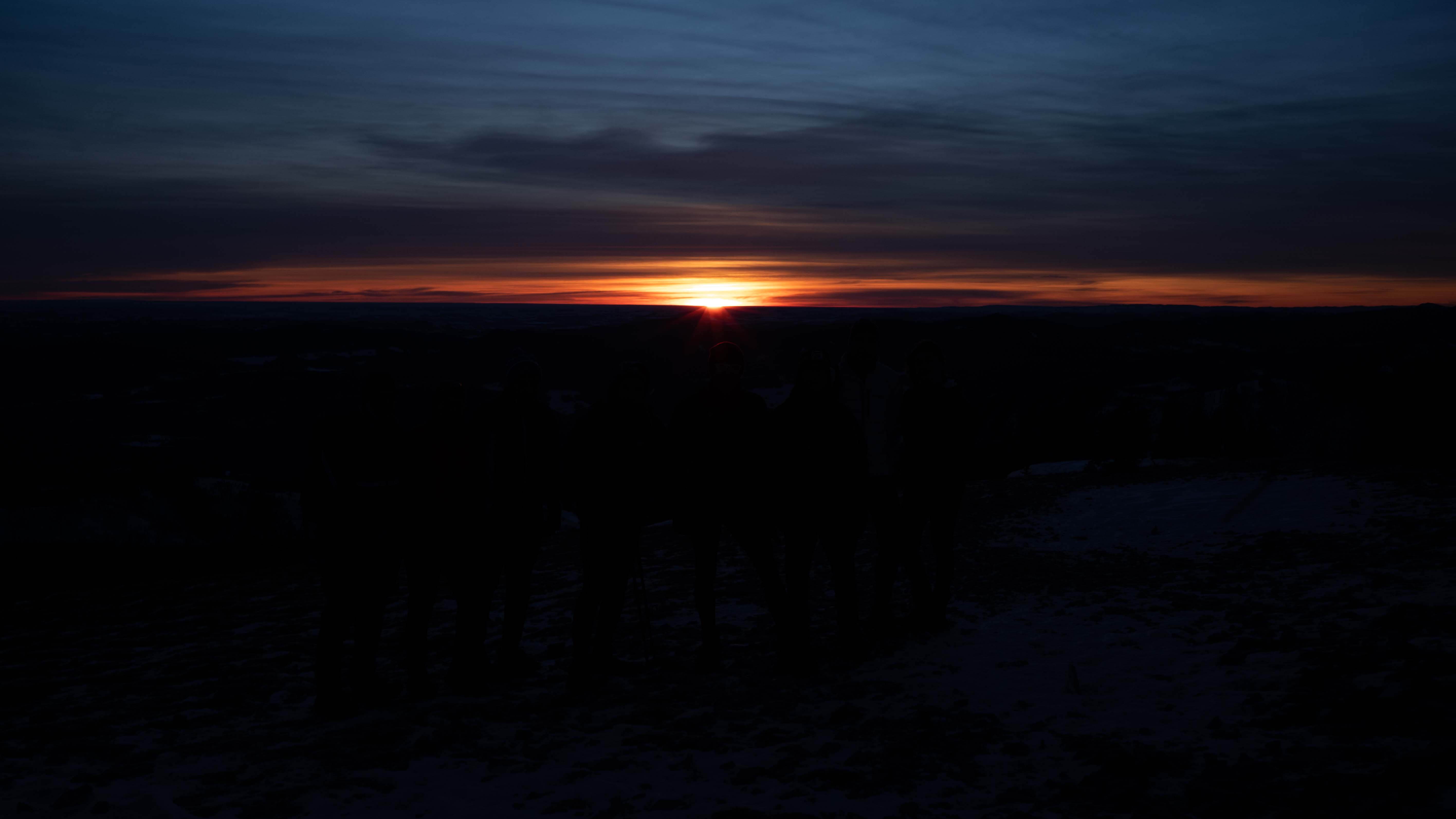
Just as Santa can be counted on for a visit in late December, we look to my friend Tim to reveal the details of the annual Prairie Mountain Winter Sunrise Hike. True to form, Tim set the date for the 2025 hike on December 29. Sunrise on that day would be, within a few seconds, the latest of the year.
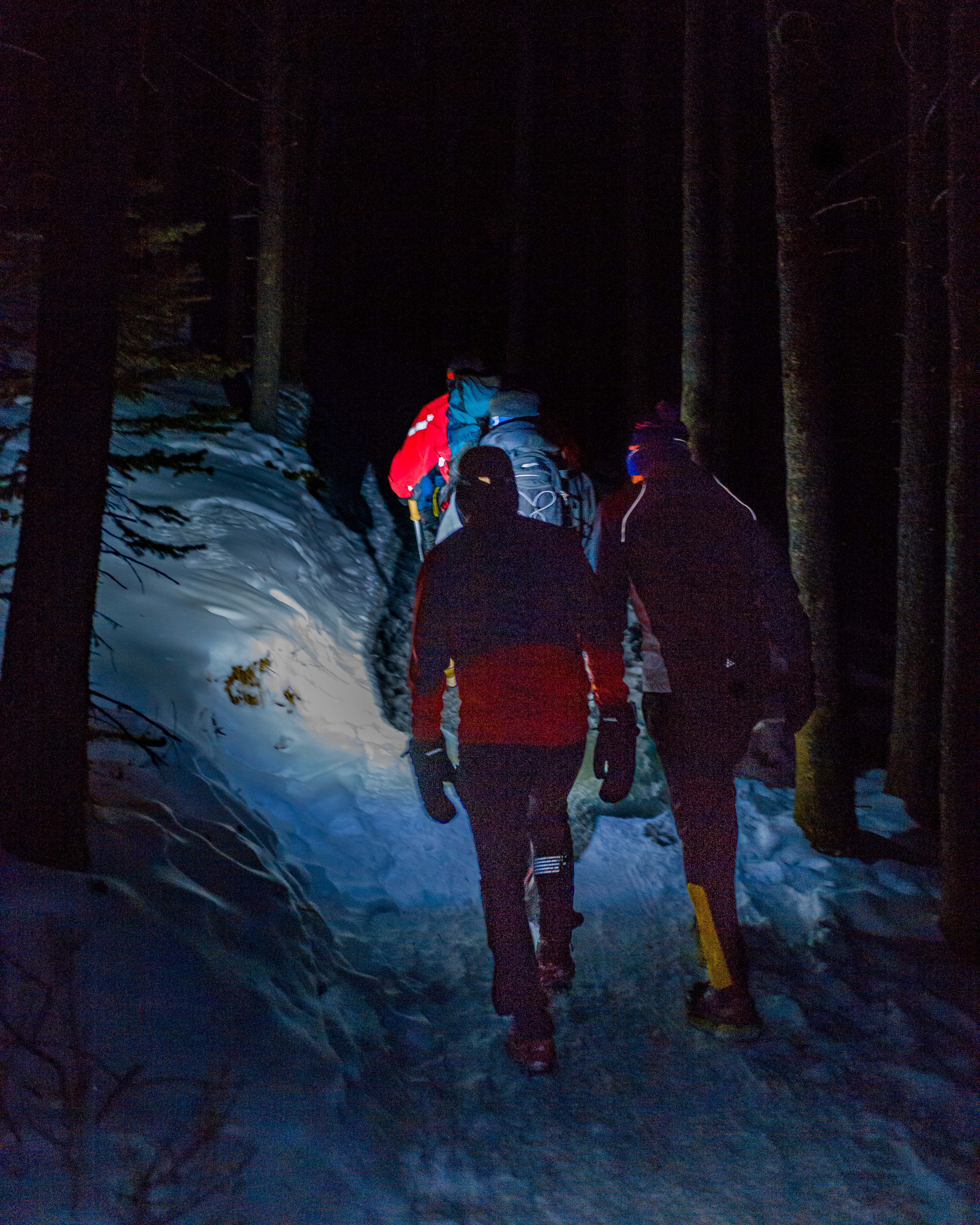
Working back from a target of 8:39:33 a.m., our convoy of eight hikers met up at the Tsuut’ina Subway on Buffalo Run Boulevard at 6:10 a.m. With practiced efficiency, we were geared up and on the trail by 7:00 a.m. We expected to have ample time to reach the summit.
I’ve posted on our previous PM hikes, and I’m pleased to say these pieces have been popular. In 2023, I shared photos of a beautiful sunrise in Part 1: The Hike and delved into the mysteries of the celestial world for Part 2: The Science. We were not deterred by last year’s cloudy conditions—you can read about that hike here. This year’s forecast suggested that the star attraction would likely make a return appearance.
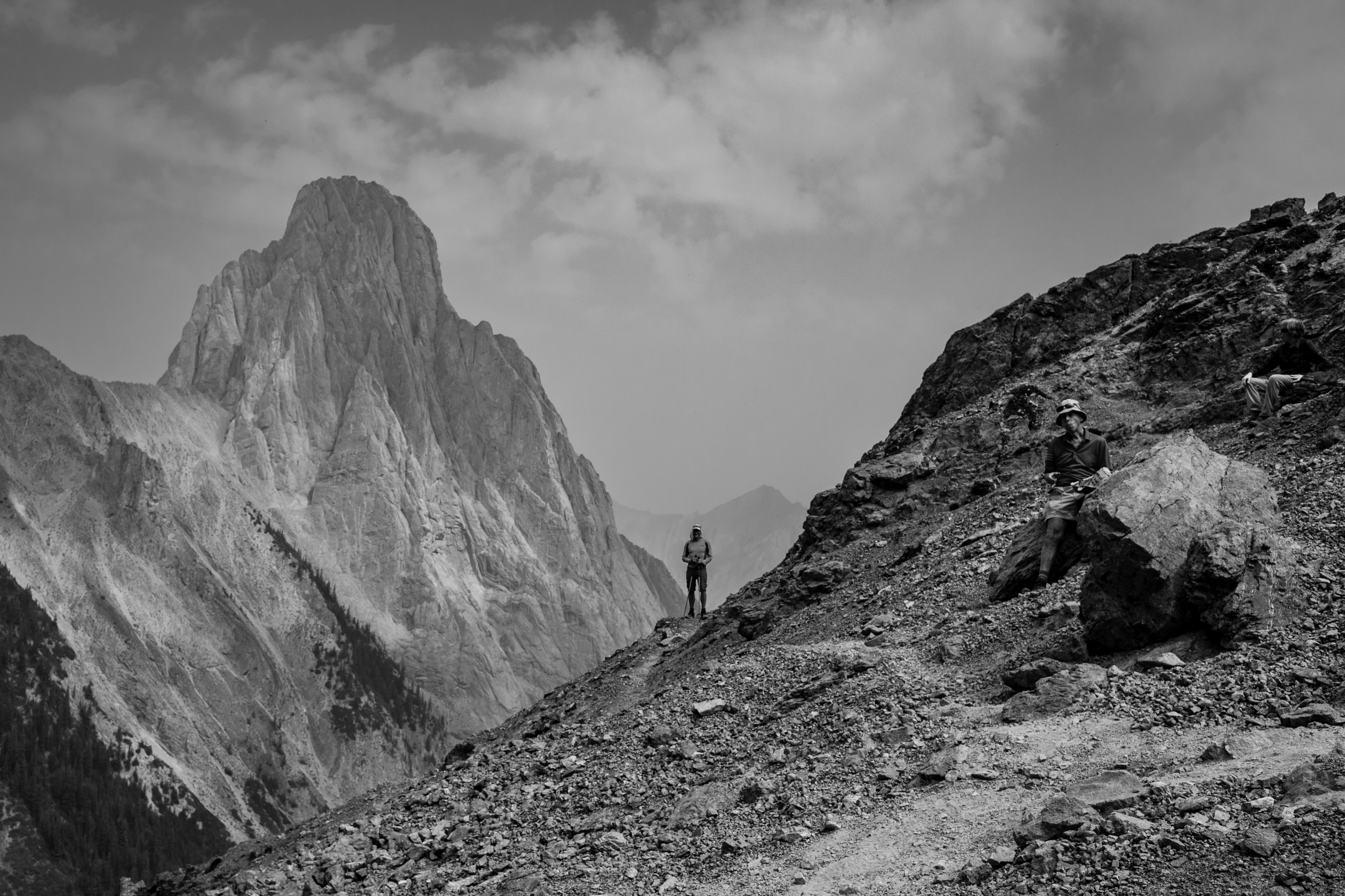
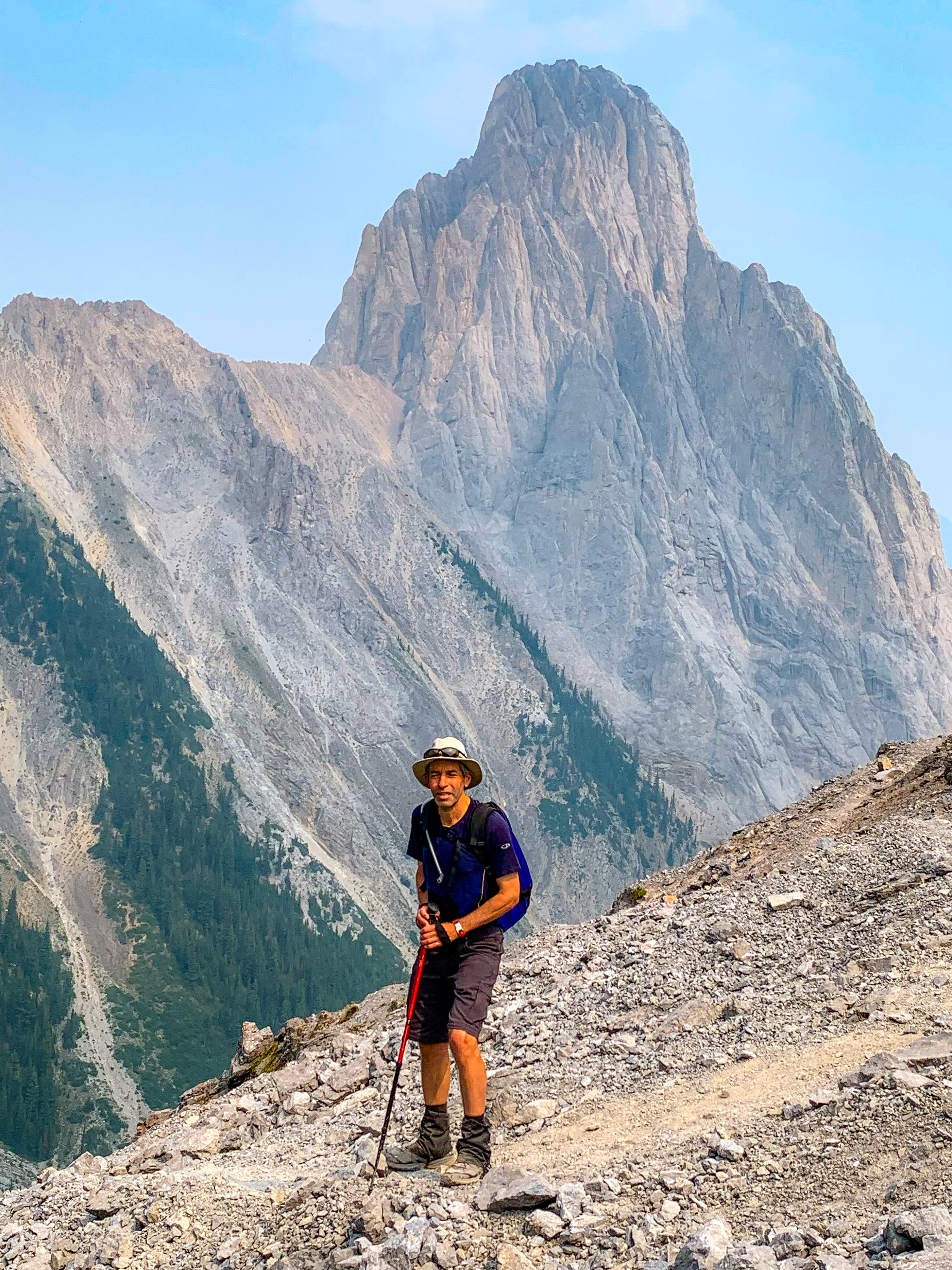
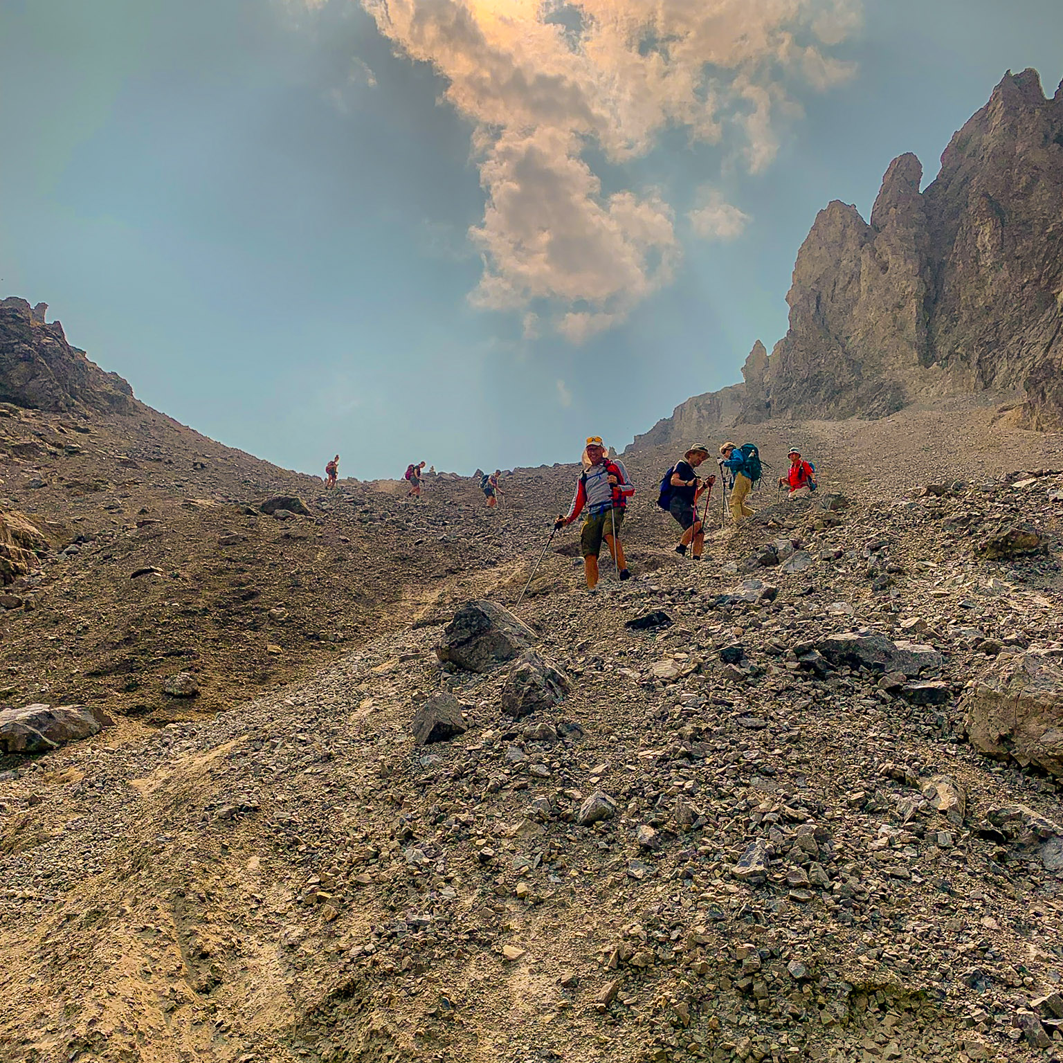
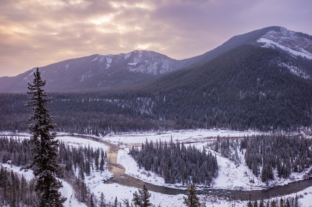
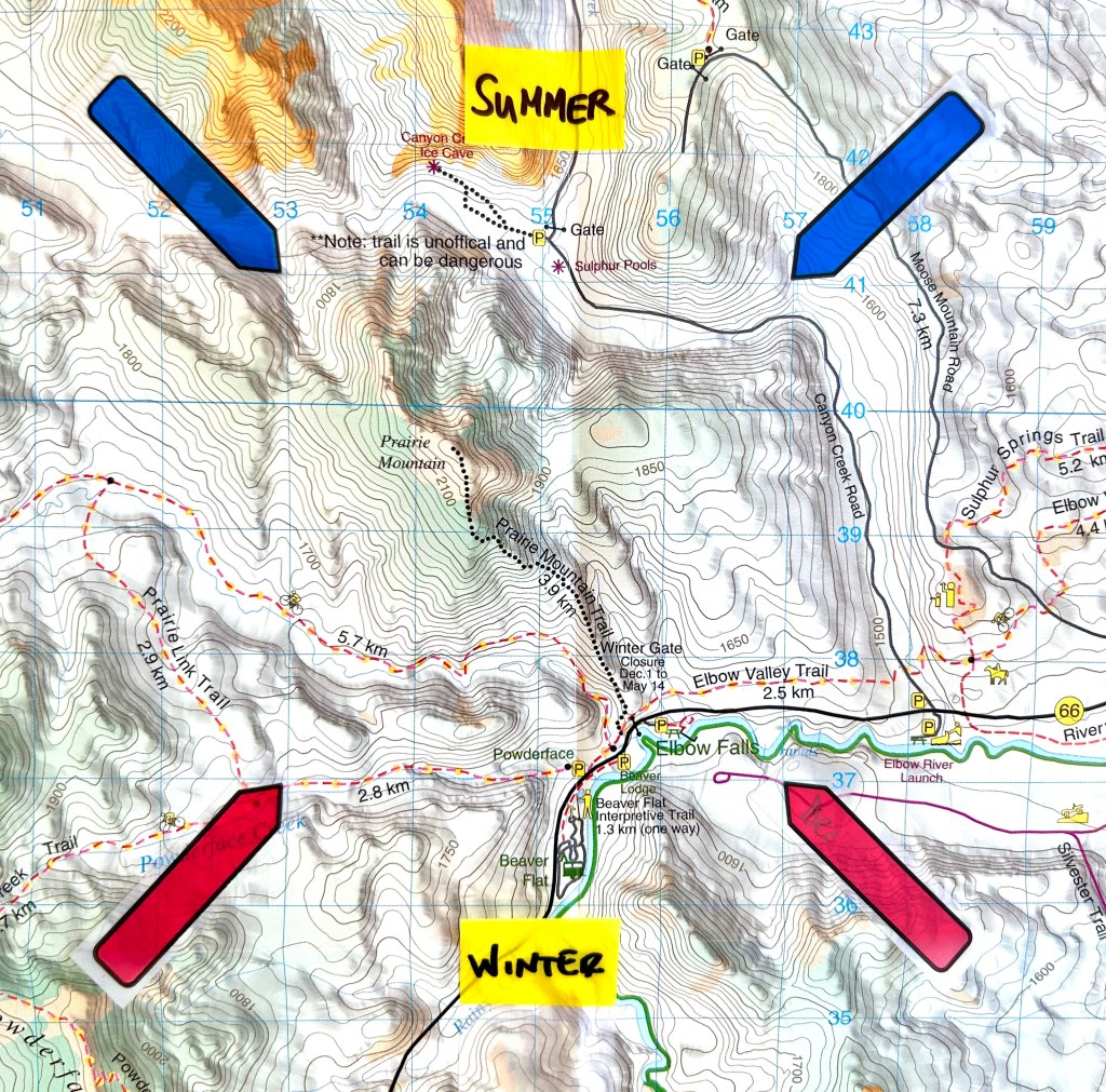
For readers who are unfamiliar with Prairie Mountain, it is the most accessible mountain for Calgary hikers. Accessible doesn’t mean easy, though—this is a good workout at any time. Last year, I noted that the hike seemed to be tougher than what I remembered. This time out, I had the same feeling. I’m not sure I like that trend! One foot, then the other. Repeat.
The Hiking Bit
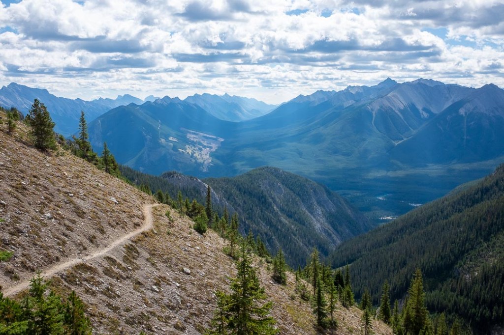
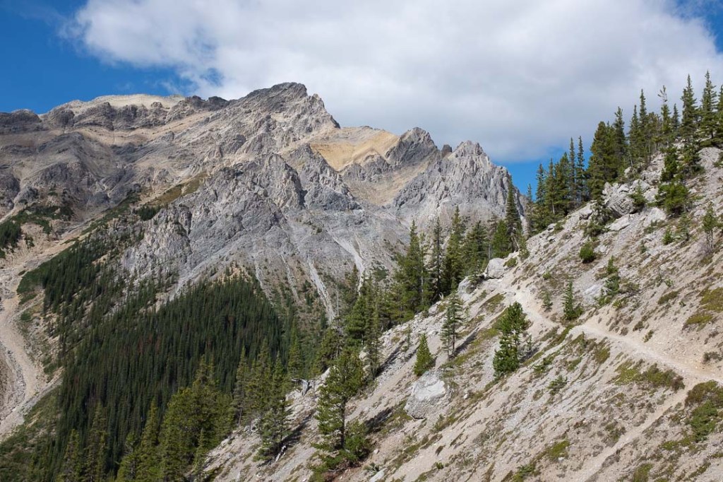
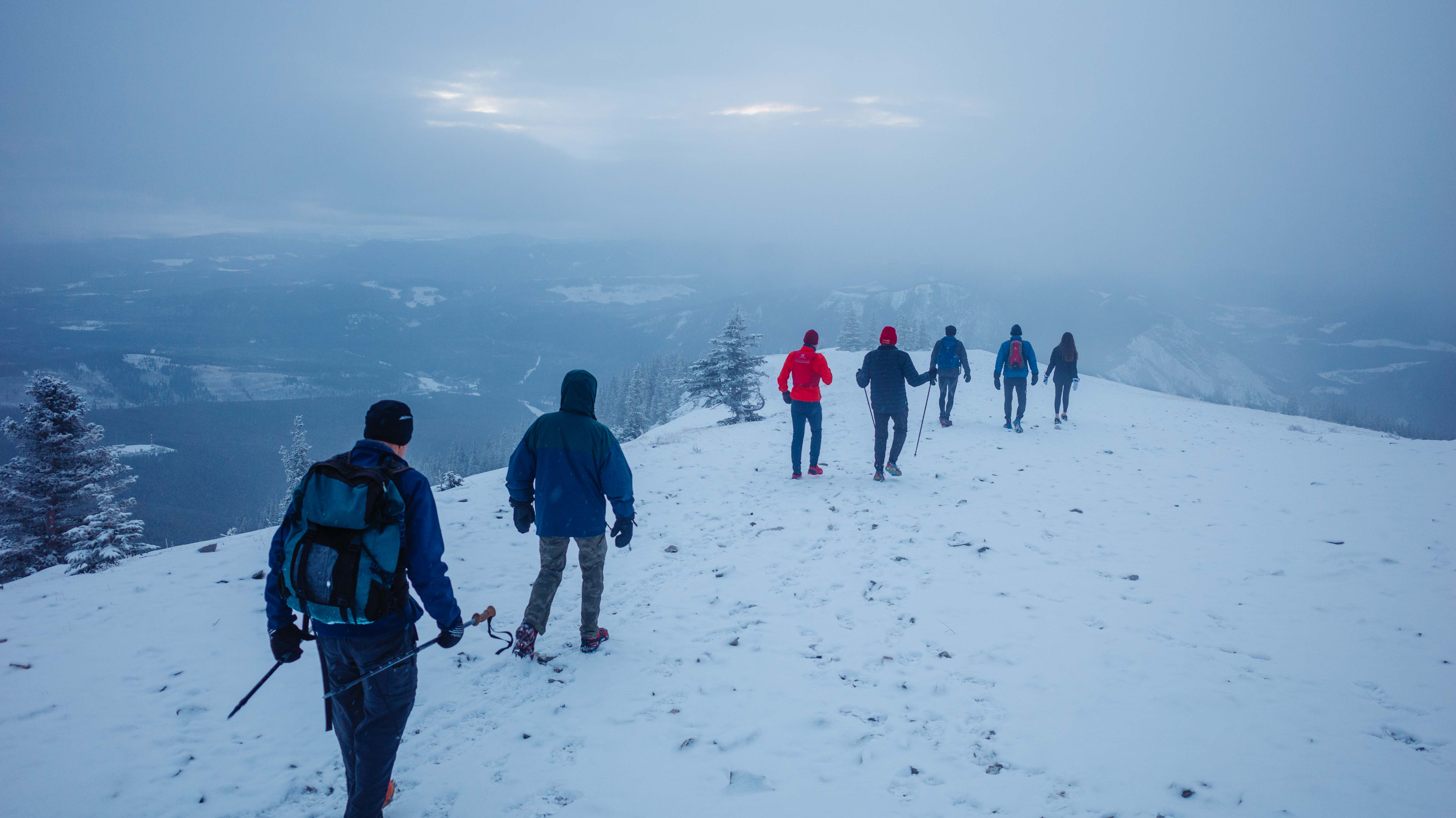
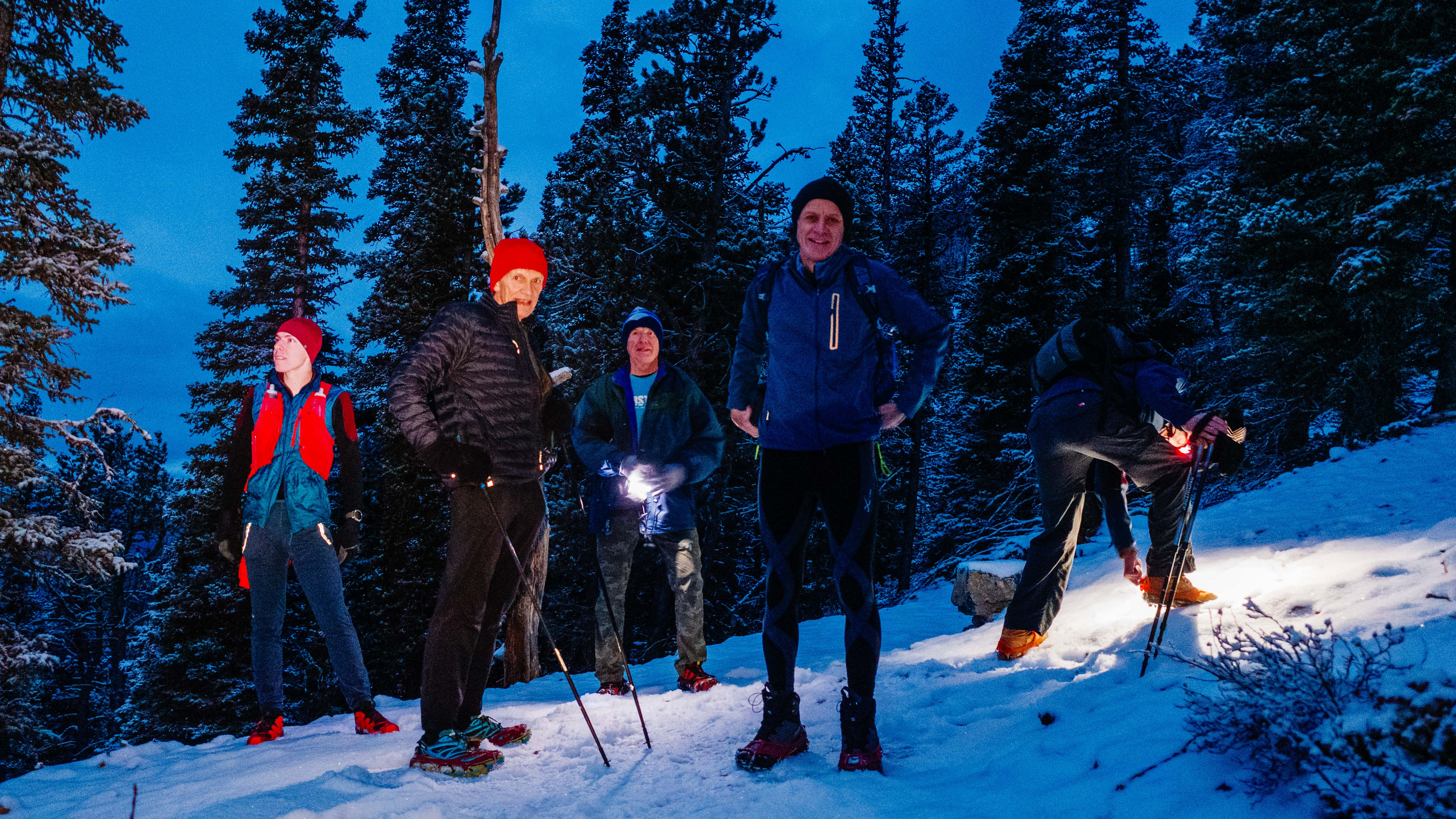
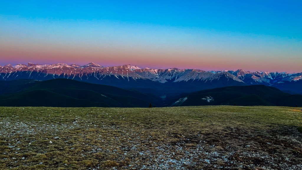
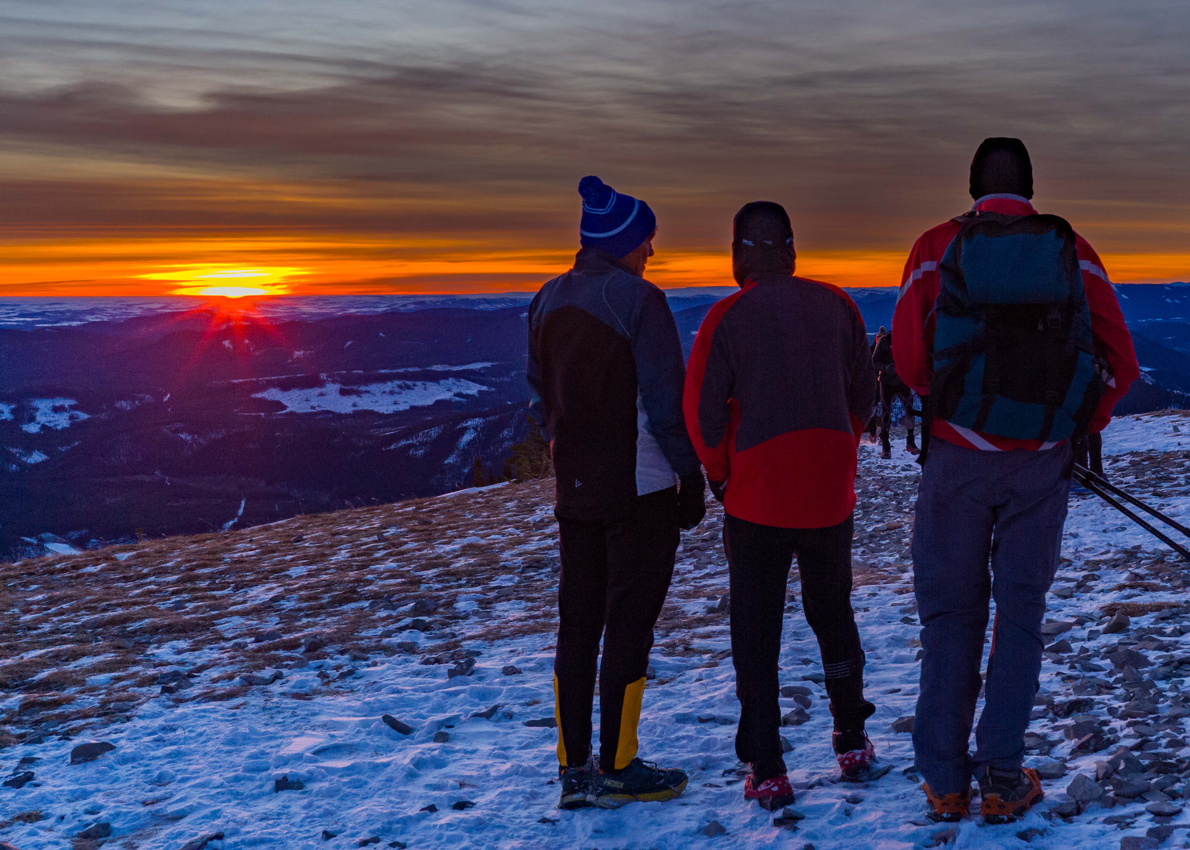
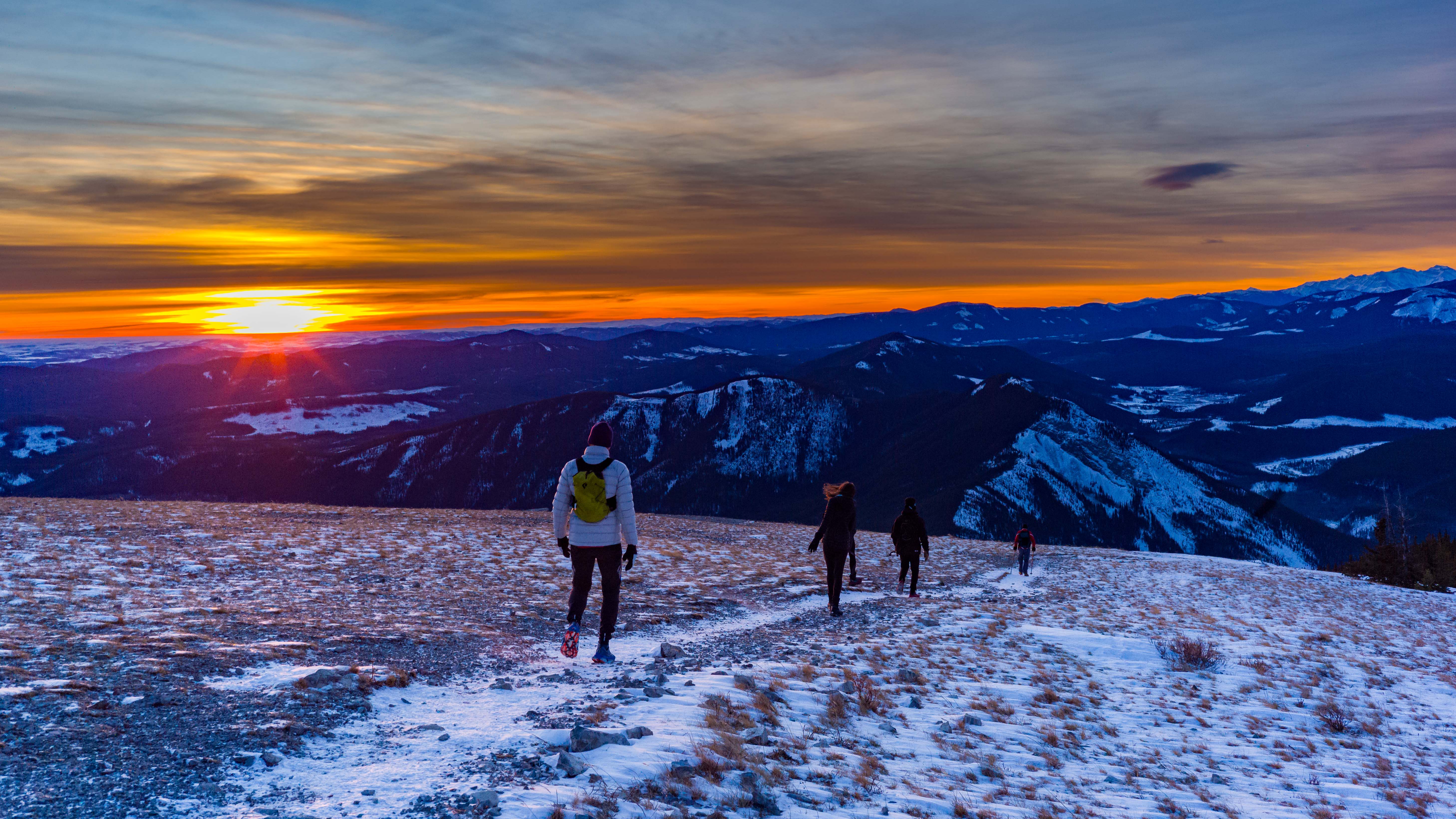
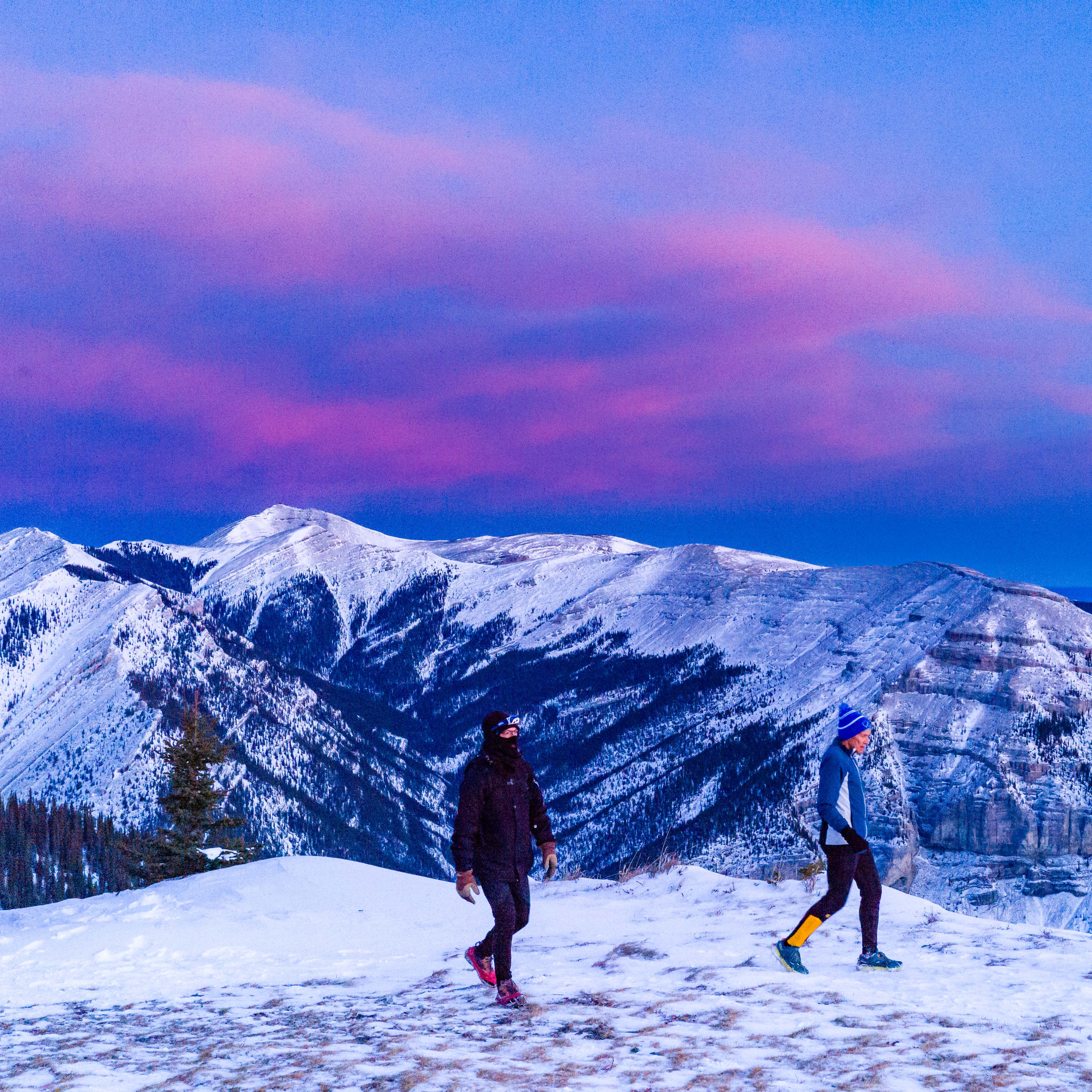
Given the snow-packed conditions on the trail, I was (again) very thankful for the new stone steps on the toughest sections. Even so, I welcomed a short pause at the first lookout, where we switched off our headlamps. I couldn’t help but notice the vibrant orange light to the east, which was already impressive as we approached the summit ridge. Were we too late?
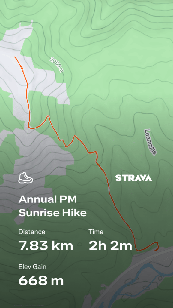
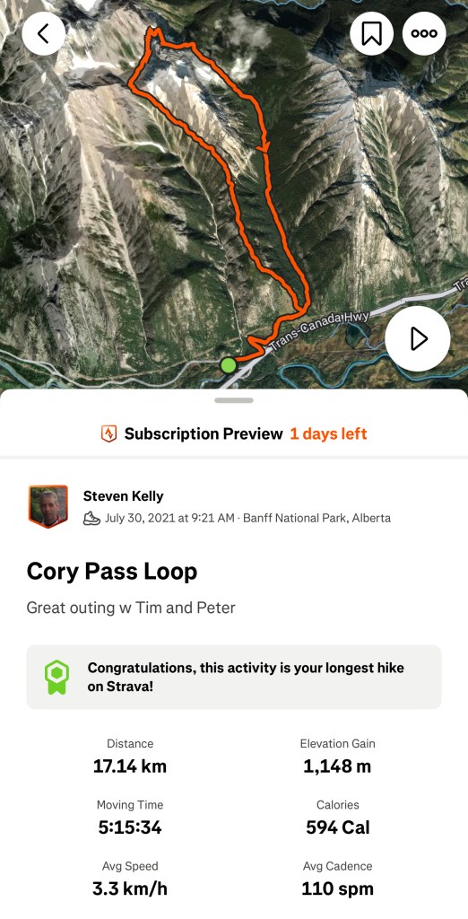
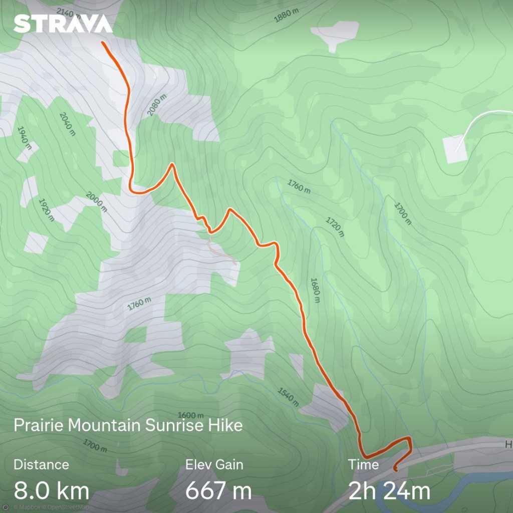
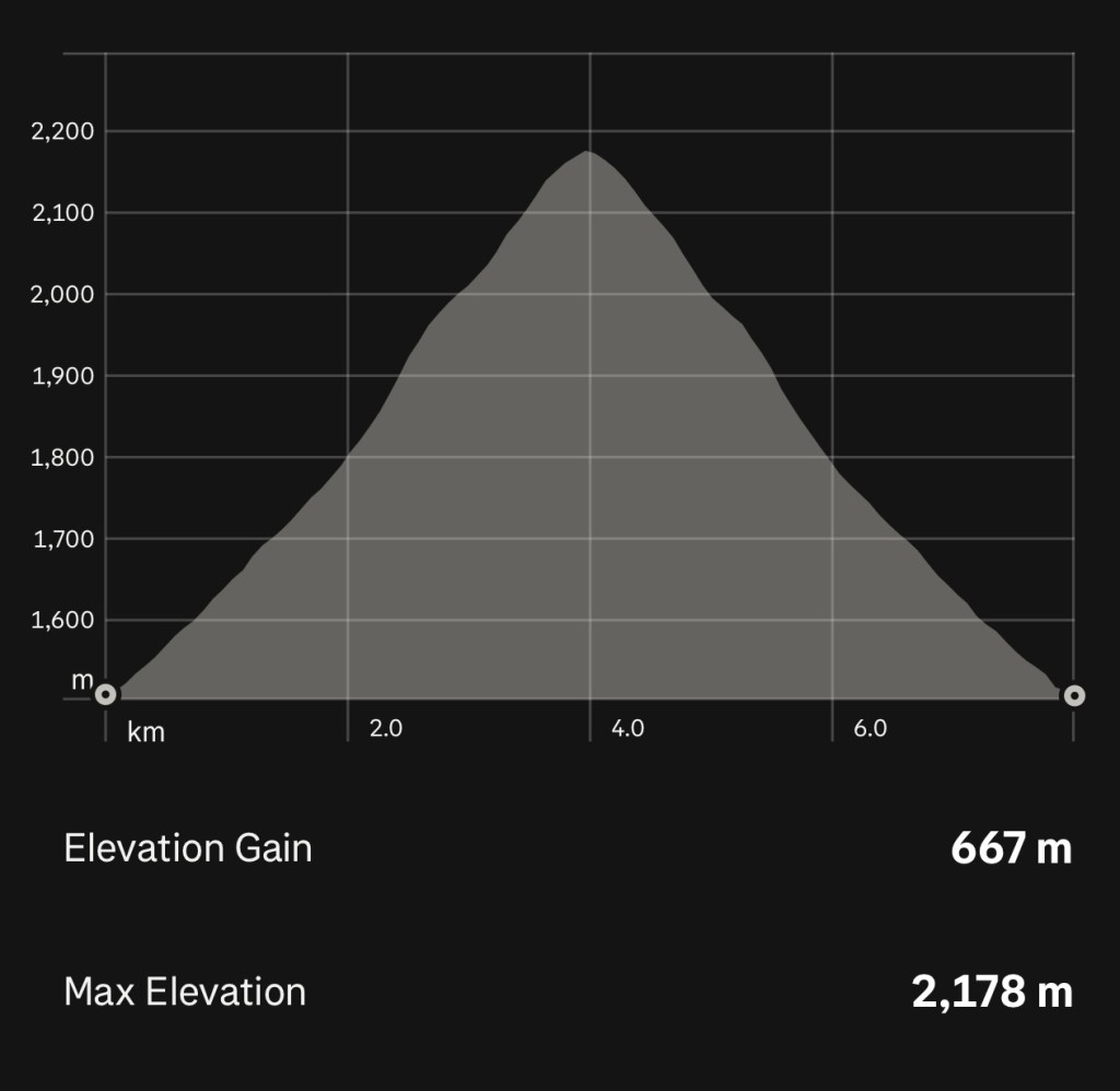
Because any PM summit is an impressive achievement, here’s my Strava activity summary.
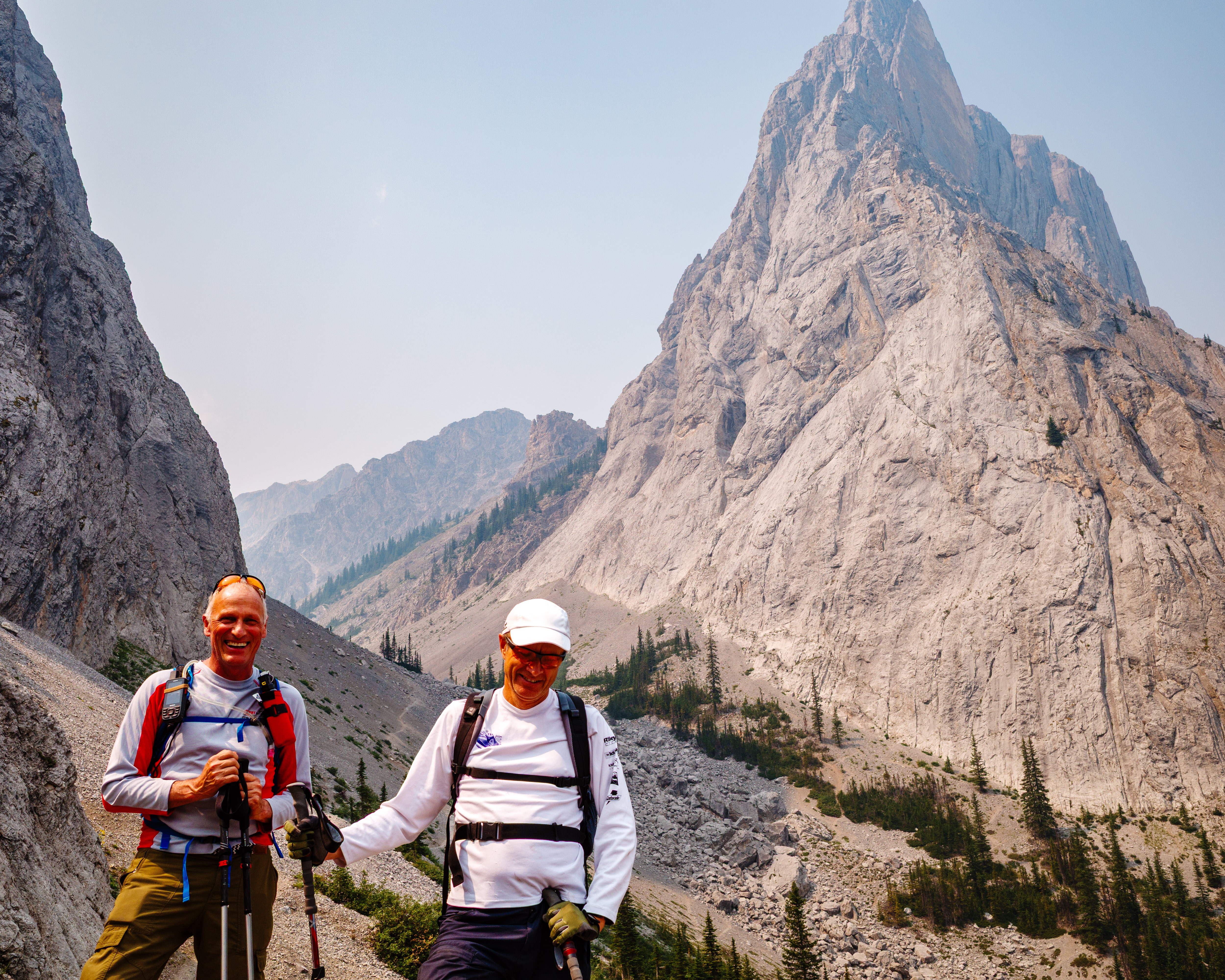
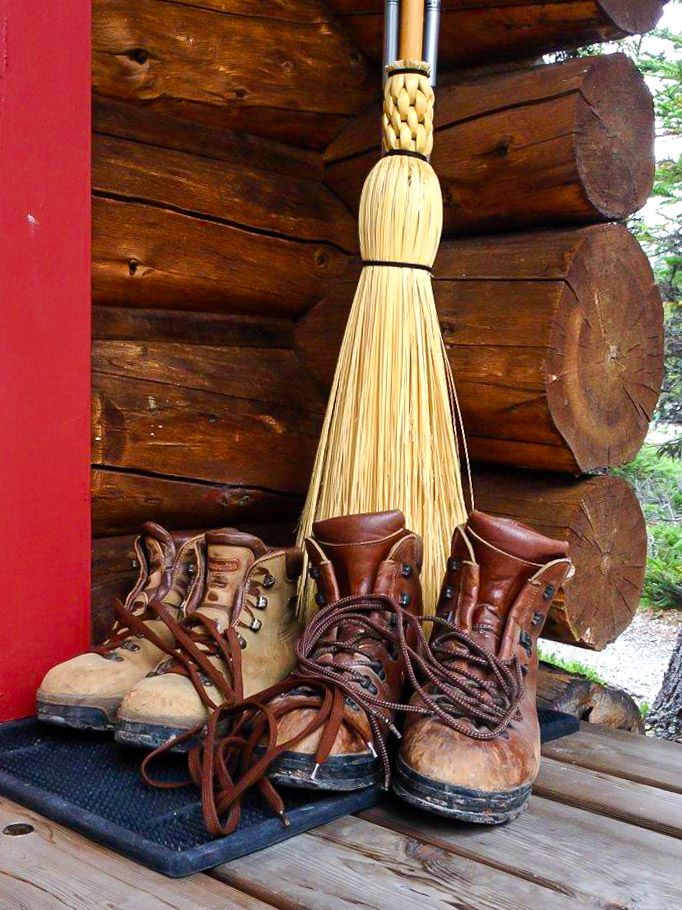
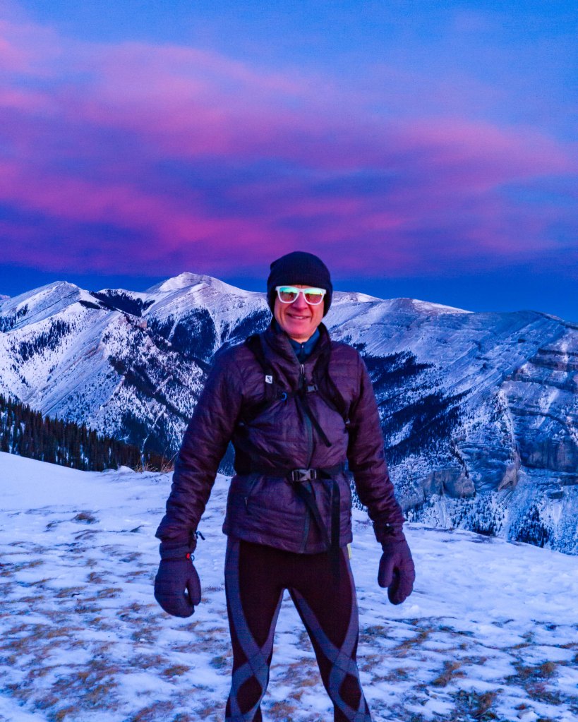
A few words on equipment. I decided to bring my “good camera”, the totally manual Leica M10. It’s a wonderful camera, but when you are bringing up the rear in the dark, as I was, adjustments are challenging. That meant I came home with blurry shots of my hiking partners’ backsides and severely underexposed images. Overall, I think the Ricoh GR III is better suited to this task. As always, my Kahtoola Microspikes and ancient red Komperdell poles were a necessity.
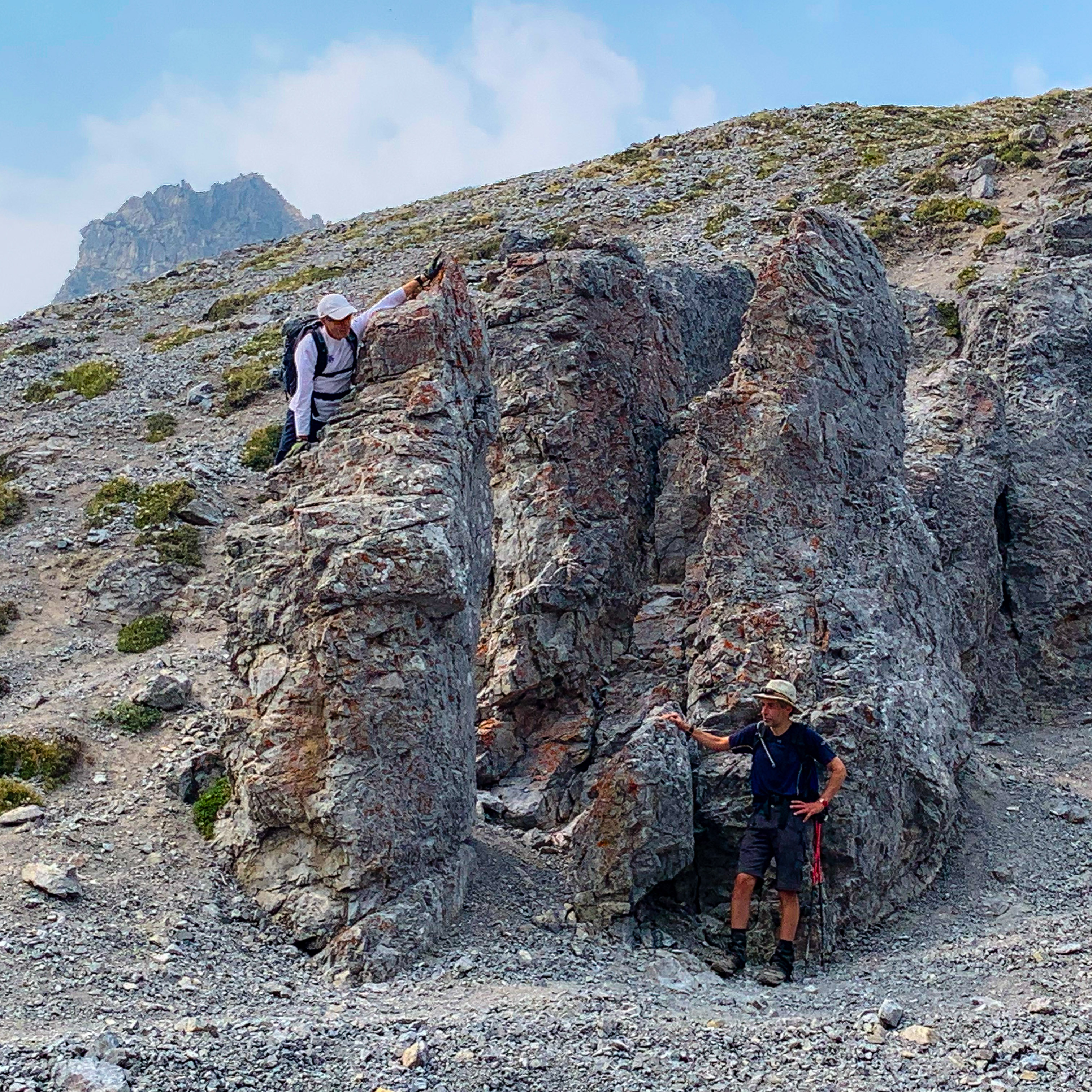
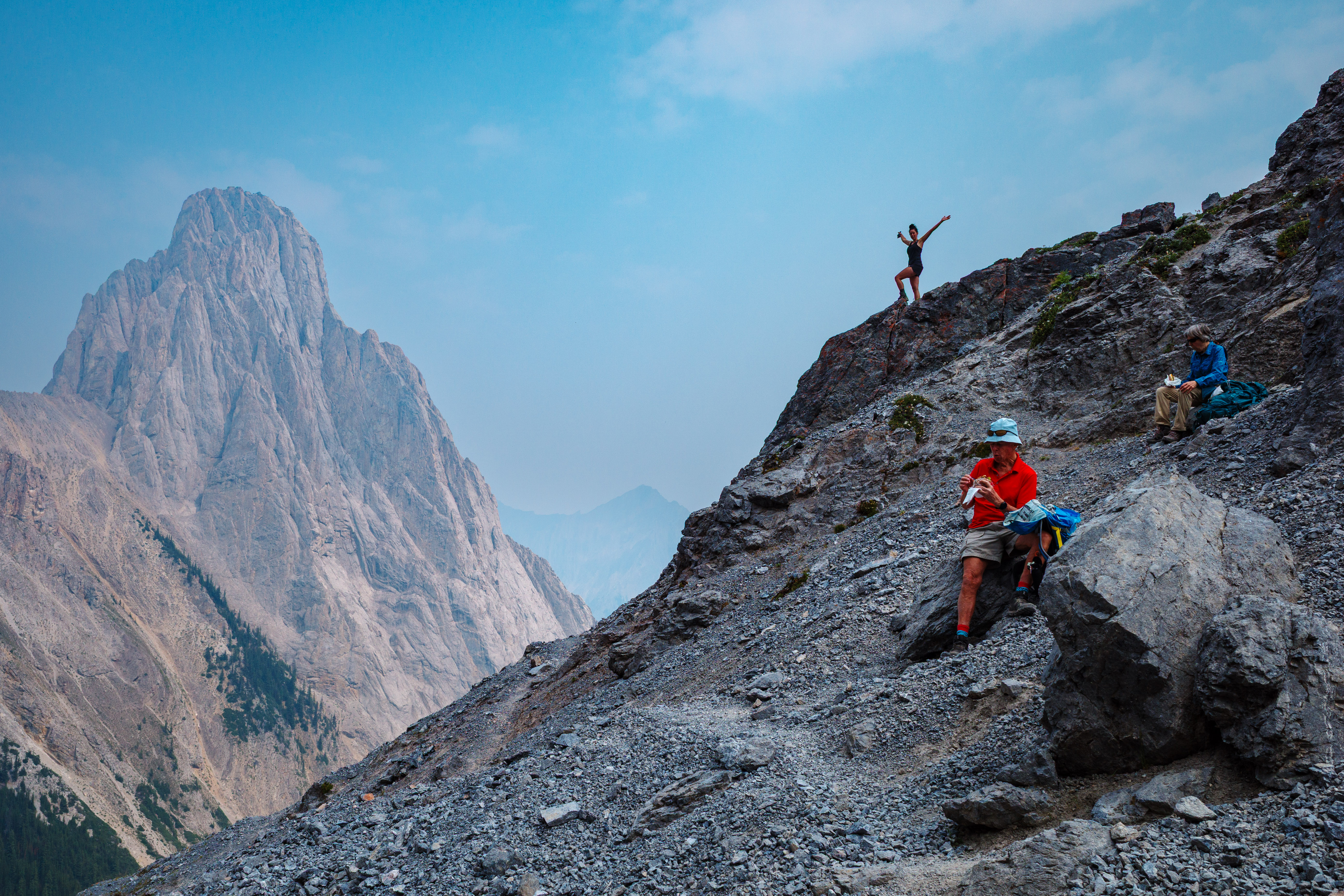
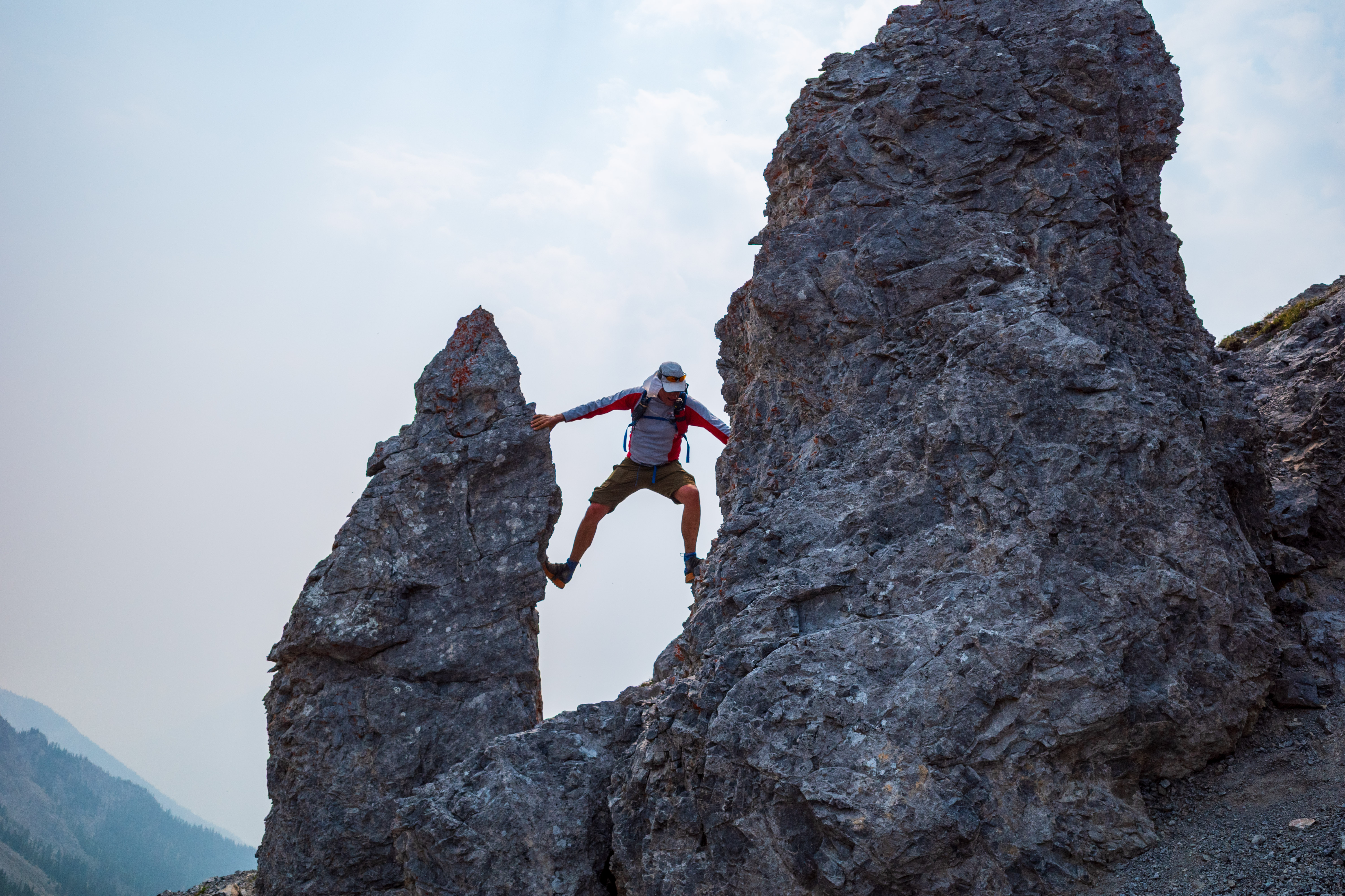
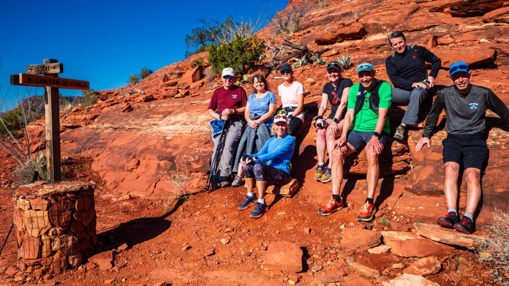
As usual, our group set a steady pace. (I hang around with some very healthy folks.) It’s hard to blame my comparatively slow pace on my photographic duties unless I present a few photos. So here’s the evidence!


Note: Copyright for all pictures is mine
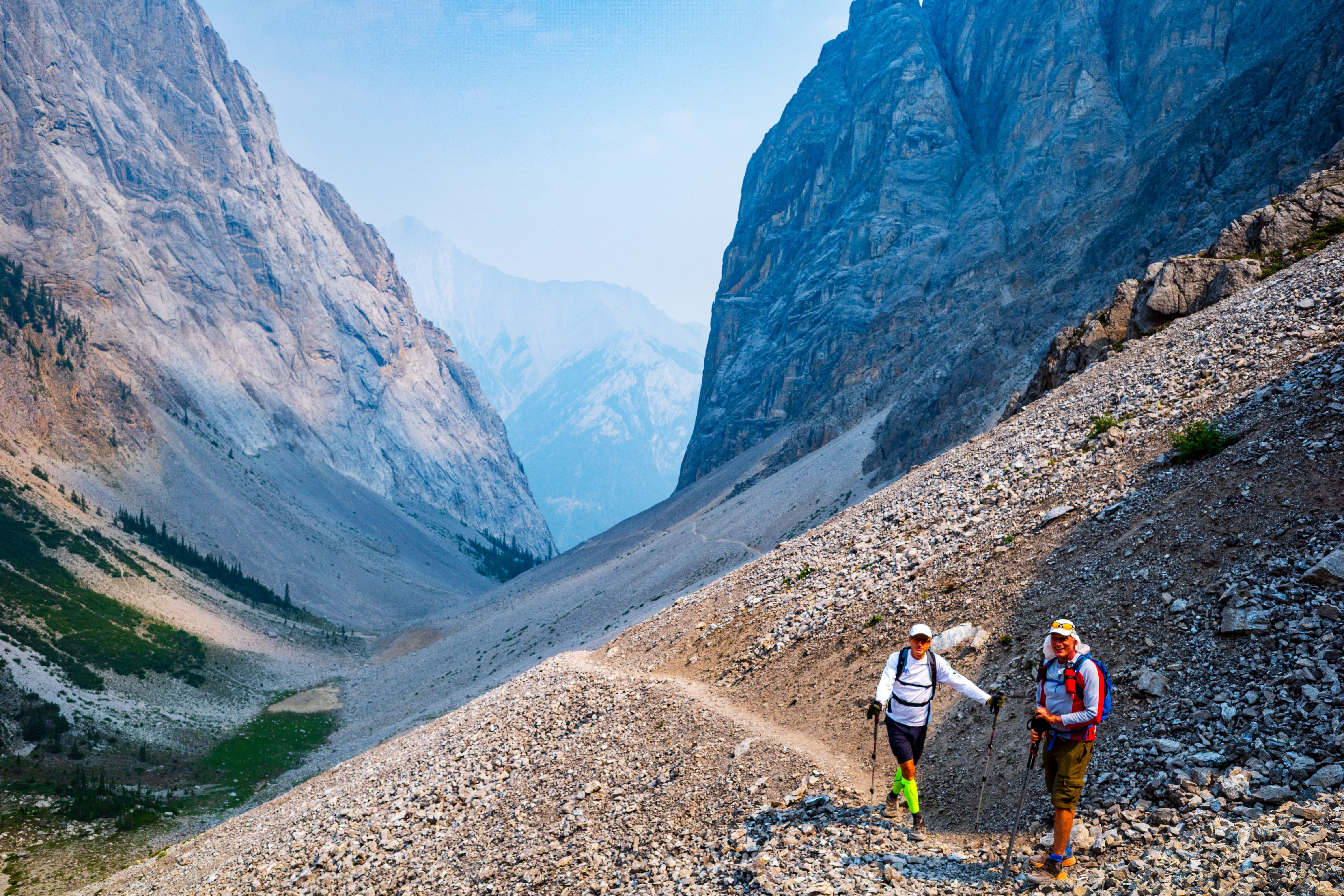
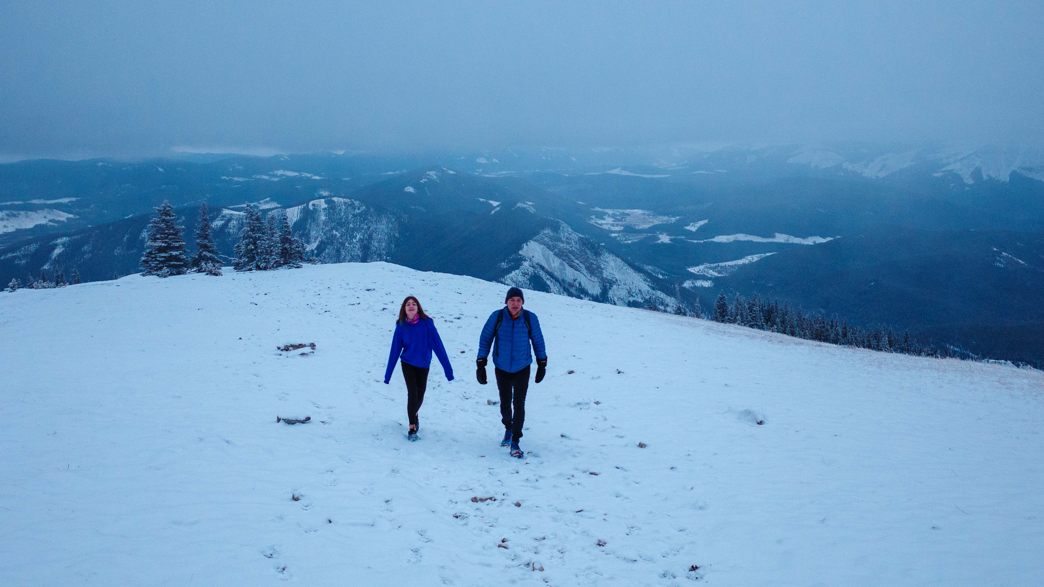
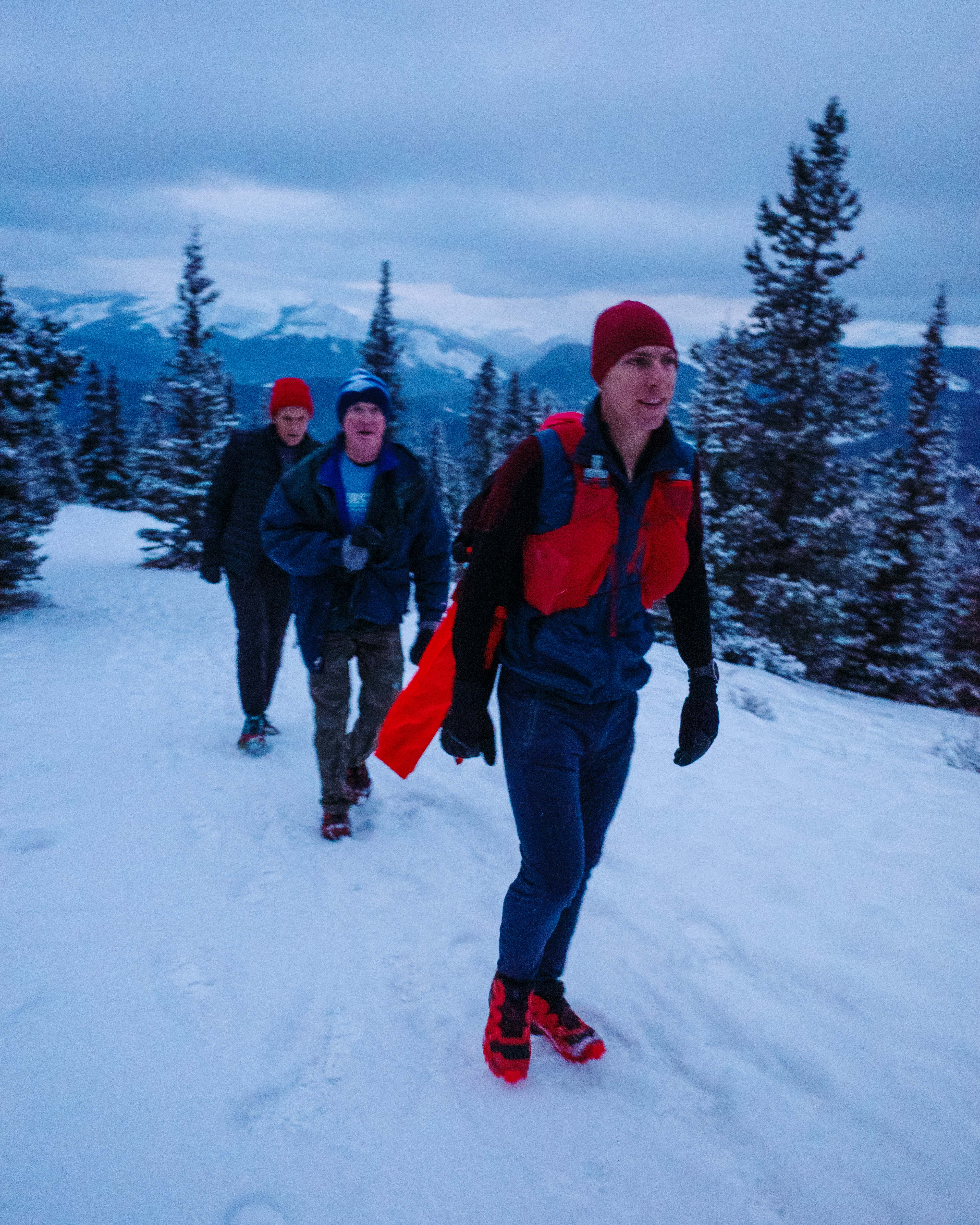
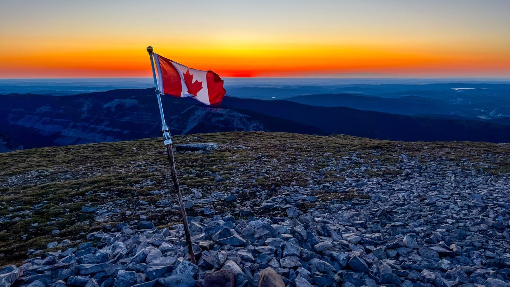
We enjoyed the relatively mild temperature (-5C) and the shelter of the treeline for most of the hike. However, as soon as we reached the summit ridge, we were immersed in a strong westerly wind. We slogged the rest of the way up the ridge. The small Canadian flag on the summit cairn was no match for the stiff breeze. We headed for the shelter of a few scraggly trees below the summit to wait for the rest of our group. With fingers losing feeling, operating cameras and zippers became almost impossible. There was no loitering at the top on this day!
The Technical Bit
Given the challenges I mentioned with manual camera settings, I thought it might be interesting to present a comparison of my pre- and post-editing for one of this year’s key PM shots. I suppose this is called making lemonade out of lemons.
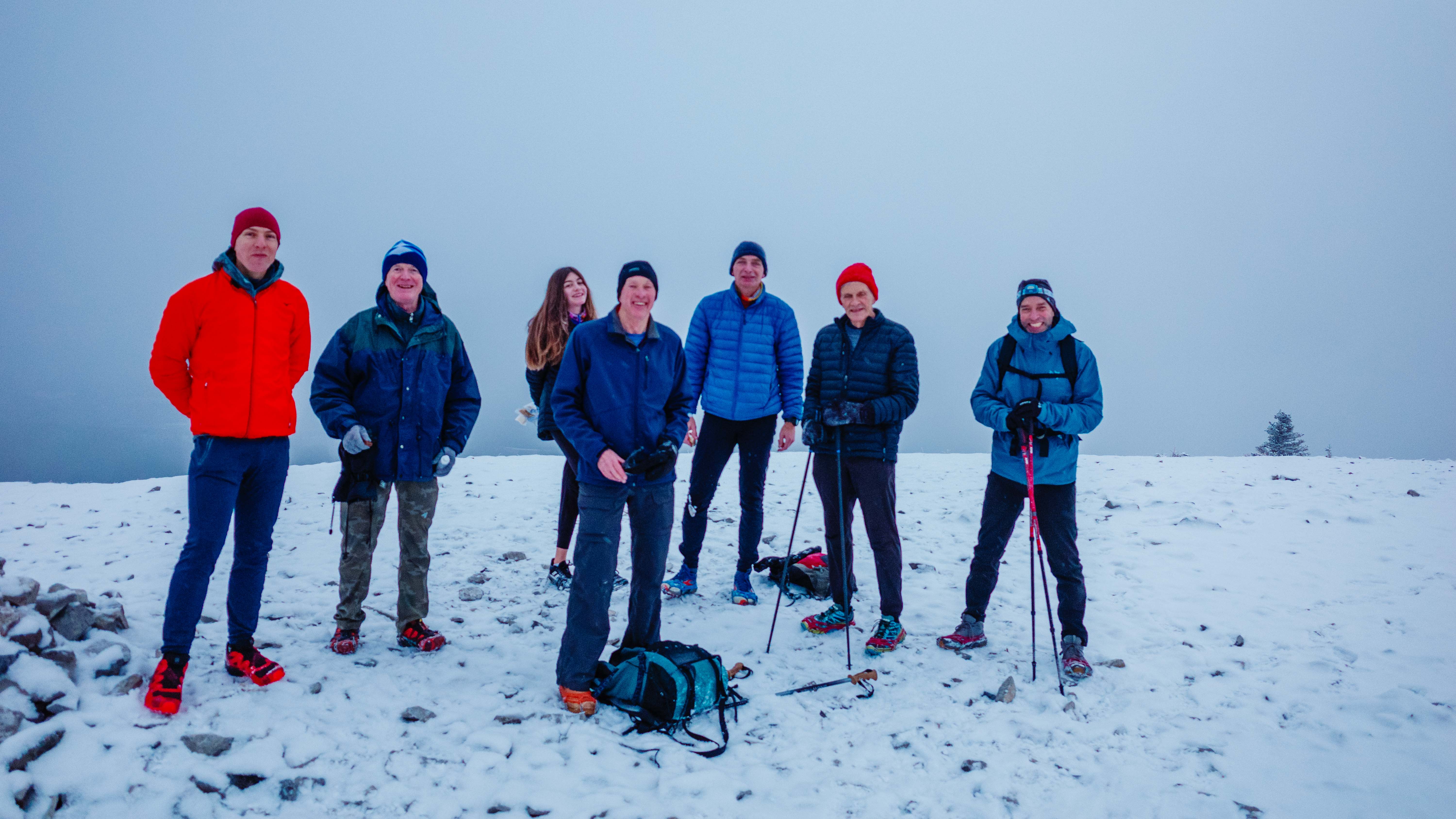
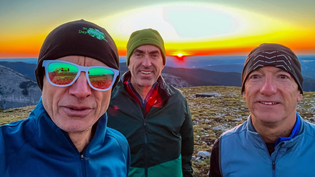
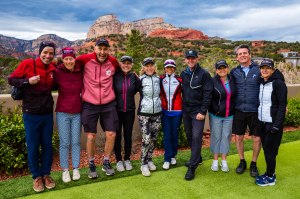
Of course, everyone hopes for a good group picture at the summit. This year, we imposed on a solo hiker who reached the summit just ahead of us to do the honours. Now, my comment that “the settings should be fine” must be tempered with the reality that I didn’t actually look at these before handing over the camera. Yes, I was freezing, the wind was howling, and for all I know, he had never touched a manual camera before. I’m fully to blame for any technical shortcomings. That said, my heart sank when I saw the images straight out of the camera. However, with some comprehensive (and slightly desperate) work in Lightroom Classic, I managed to extract a passable image. You can compare the before and after image here:

At the risk of losing some readers, I’ll summarize the edits I made to this image in my attempt to rescue it. First, I increased the overall exposure significantly—a whopping 3.5 stops. I think the meter was fooled by the sun in the centre of the image. Then I dropped the sky by a stop, and raised the foreground by almost another stop. I raised the white balance to warm the image up slightly. I dropped the highlights, mostly around the sun, and raised the shadows. Then I increased the saturation, clarity and dehaze. That left me with a noisy image, which I tried to fix using the latest AI tools in Lightroom. In the end, I gave up, as all this did was create artifacts that were, to my eye, worse than the noise.
So, as long as no one looks too closely, this is a fair reminder of what it felt like to stand on the summit that morning. My homework for next year is to be better prepared.
Wrapping Up
With the start of a new year, one is often moved to contemplate things that truly have value and be thankful for people who are important in life. I’m very fortunate to be surrounded by like-minded people who value fitness and friendship. And we are all blessed to have special places like Kananaskis just a short drive from home. Thanks, Tim, for getting us out there and up there again.
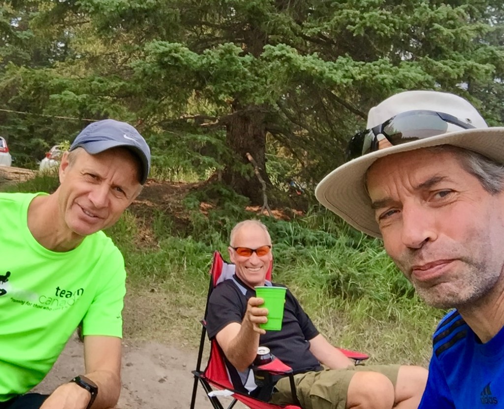
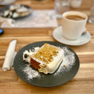
The annual winter solstice hike was a great experience and a perfect end to the year. Oh yes, the post-hike coffee and baked goods at the Handle-bar Cafe in Bragg Creek were delicious. And well earned.
Until next time, be well, BE FAST—and Happy New Year to all!