Prairie Mountain Sunrise, Part 1

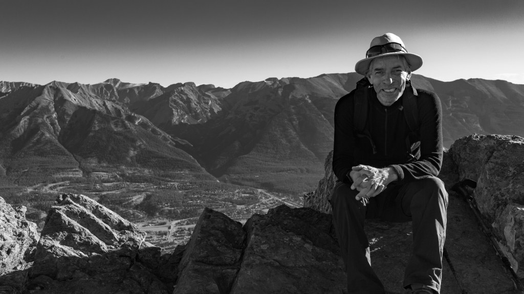
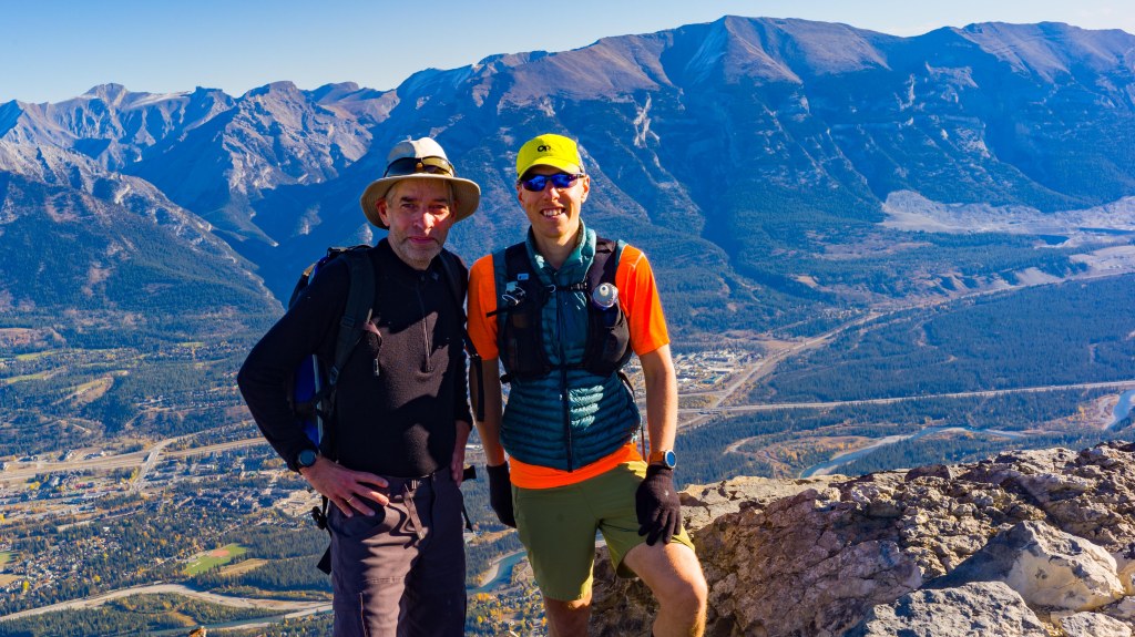
My friend Tim can always be counted on to organize good outings. A coffee, a lunch, a hike. He organized our excellent excursion to Pocaterra Ridge in September to see the larches.

One of Tim’s good ideas in the last few years is a sunrise hike to the summit of Prairie Mountain in Kananaskis. He’s been considerate enough to arrange the hike on the day with the latest sunrise. This year, that day was December 29. Before the hike, I didn’t independently verify Tim’s assertion on this point. More on that in Part 2 of this post. But I did enjoy the extra two minutes of sleep that I was told would be available by delaying our hike from the winter solstice by eight days. 

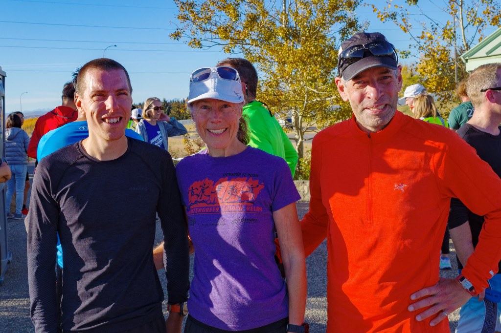
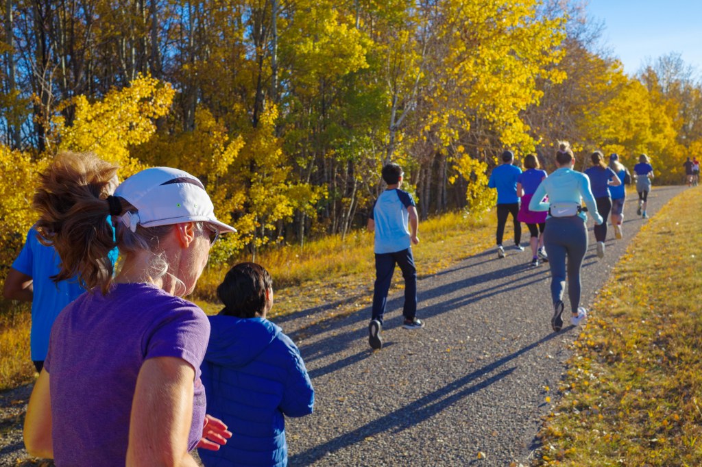
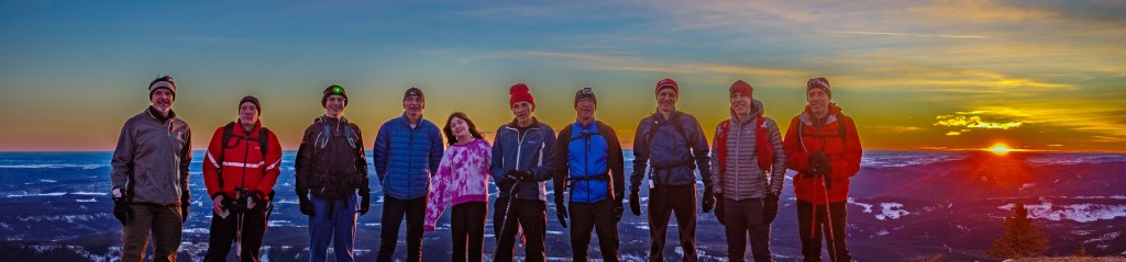
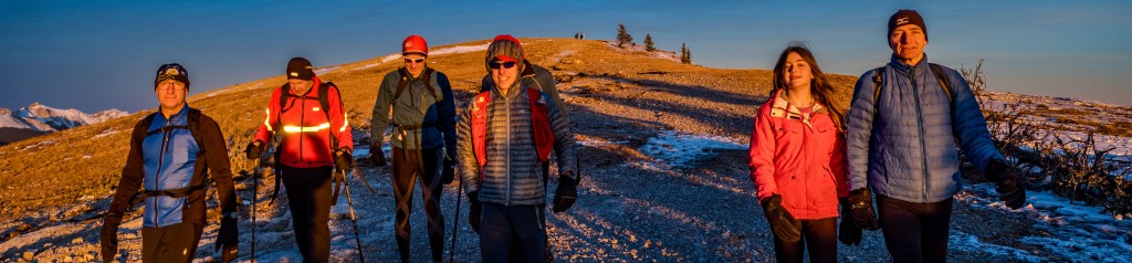
Dan and I joined the convoy that left Calgary at 6:20 to reach the trailhead by 7:10. A testament to the popularity of Tim’s idea is that our group was ten this year, up from five last year. Mind you, last year’s -20C temperature may have been a contributing factor. (I passed on that one.)

The hike was great. It was my first time on the new and improved Prairie Mountain trail. It’s now 8.4 km with 711 metres of elevation gain. The modifications evened out the trail’s steepest segments, added some Lawrence Grassi-like stone steps in a couple of places, and widened the trail. Even in the dark, lit by a headlamp, I liked the changes. I’m not a PM veteran or a mountain goat. I have done the hike maybe six times, in various weather conditions. And I’ve been in a couple of slippery situations on the old trail that left me wondering if we’d taken a wrong turn. It just never seemed safe to me. Now it does. 

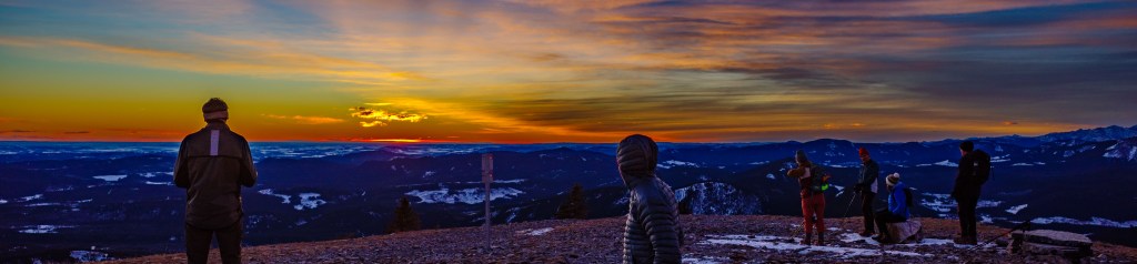
We may have been a bit late getting started. The southeastern sky was already lit with beautiful shades of pink at the first viewpoint. We hustled onward, knowing that if we could get onto the summit ridge we would see the sun break the horizon. Our time for the ascent was about 75 minutes. 

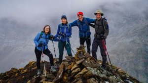
We didn’t have long to wait once we reached the 2,210-metre summit. The light display was stunning. Sunbeams streamed around a lone cloud that was parked just above the horizon. 

First rays (December 29, 2023)

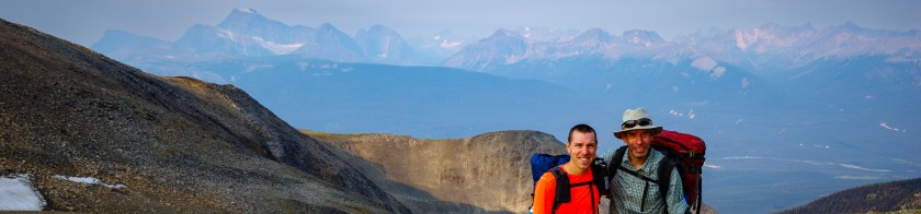
I had my Ricoh GR III with me. (Yes, I know, I say this often, but I really love this camera!) We snapped a few group shots as the sun made its appearance.

The group, on the summit

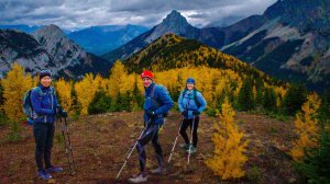
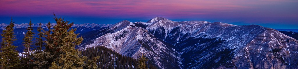
To the northwest, Moose Mountain was glowing, with snowy highlights and a rosy sky above. 

Moose Mountain looking splendid

We enjoyed the vistas and took more photos. As I reached for a snack, I realized that my fingers were freezing. It was deceptively cool, but thankfully the summit winds were moderate. That isn’t always the case on Prairie. We started down, trading our headlamps for sunglasses.

On the descent

An enjoyable coffee and treat at the Bragg Creek Cafe & Baking Co. rounded out the morning. 

Happy New Year to all!

Very Thankful Indeed!

Thanksgiving weekend was a satisfying one for your blog host. We Canadians roast our turkeys on the second weekend of October, rather than waiting another six weeks like our friends to the south. 

The first order of business was another parkrun. We had a special visitor from Cold Lake for the weekend who was up for the challenge. Dan was seeking more mountain adventures, and yes, the promise of a turkey dinner. There was no better way to start the holiday weekend.

Ready to run, Nose Hill parkrun 287

Conditions were ideal. Dan took off right from the gun, while Deb and I settled into a more pedestrian pace. Unlike our foggy Nose Hill parkrun (#285) of two weeks earlier… our first… this Saturday morning brought fine fall weather.

Clear skies meant we could see every detail of the challenging circuit. It includes mixed hard asphalt, gravel and a short section of single track. The Nose Hill course consists of two laps of about 2k each, with an out and back section making up the 5k distance. It’s a good test. 

A perfect fall day on Nose Hill

We enjoyed a brief peek of the mountains at the far end of the course. (The dusting of snow there was a prelude to our next adventure.)

When we arrived at the finish line, Dan was already cooling down, having put in a  hard tempo pace to reach his goal of a sub-20-minute 5k. We were content with a finishing time that was close to (okay, a bit slower than) our previous result. We headed home, all satisfied with our performances. 

The energy level is always higher around the house when Dan is there, and this weekend was no different. So, we were not surprised when he explained that his plans for Sunday included a hike in Canmore. 

I reminded myself that we would soon be lamenting the return of cold, dark and short days. I asked him to count me in. Who needs sleep anyway? 

He had selected Ha Ling Peak, a moderately challenging 8k round tripper with 700m of elevation gain. I had always wanted to try this one, especially since the trail modifications that were done in 2019. 

We made an early start, figuring that many enthusiasts would already be on the trail, all keen to burn some calories before a big dinner. In fact, it wasn’t that busy. We encountered more hikers making their way down from sunrise treks to the summit. It would have been a good one, based on the beautiful pink sky we enjoyed on our drive to the mountains. 

Our ascent was quick. We stopped only briefly at the two intermediate viewpoints. Then we marvelled at the engineering behind the wooden staircases built into the steep upper sections of the trail. Dan was nimble on the last scrabbly (and unmaintained) section before the summit, and as always, considerate enough to wait for me every so often. 

Whew! Ha Ling ascent done

I wondered how I’d do near the top, given that Ha Ling is known to be a bit of a challenge for those prone to vertigo. I have to count myself in that category, after my vertebral strokes. 

I focused on the ground in front of me, only looking up when I stopped to catch my breath. Fortunately, I had no issues at all with my balance on the day. 

Views of the town opened up below us near the top. It was spectacular; a very rich reward for the 90 minutes of effort needed to get us there. 

Dan proposed that we make the side trip to Miners Peak, maximizing our reward even more. I was slightly intimidated by the prospect, until he pointed out that I was looking at the wrong peak. We checked out the cairn at the col, before making quick work of the small peak… more of a mound… directly in front of us. 

Dan scouts Miners Peak, with Ha Ling behind

Having skipped down the mountain in no time, after meeting many groups of hikers on their way up, we made the obligatory stop at The Bicycle Cafe in town for an excellent latte. Delicious!

All in all, it was a fine and memorable weekend. It was made even better by the impressive results achieved by my Adrenaline Rush teammates (and many other Calgary runners) in top-flight marathons in Chicago, Victoria and St. George. More on that in a future piece. 

Can it get any better than this?

I feel very thankful indeed!

A Foggy parkrun and a Larchy Hike

What a weekend!

Saturday.

parkrun is a worldwide phenomenon. It started in 2004 in the UK, when a small group of runners got together for an informal 5k run. There are now more than 3 million registered runners who can show up at any weekly parkrun around the world.

As a historical aside, park runs were a thing decades ago. That was in the late 1970s, at the dawn of the running boom. I remember doing 1, 3 or 5 mile runs around Gage Park in Hamilton, which were organized by the local YMCA. Like parkrun, those runs were free and informal. But I digress…

We now have several parkruns to choose from in the Calgary area. My friend Tim (a veteran of 100 parkruns) encouraged us to give it a try, so Deb and I decided to join for our first Nose Hill parkrun, and the 285th weekly edition.

Nose Hill Parkrun 285

Fog settled over the park as we did an easy warm-up jog. The field was large, with over 150 runners. It included a large number of airline employees from around the world. They were in town to participate in the World Airline Road Race, a large race that was scheduled for the next day.

Our run went well. We handled the two laps of mixed terrain without much trouble. That said, we saw almost nothing, due to the thick fog. It did make for some interesting photos, with runners disappearing off in the misty distance.

Fog and mystery on Nose Hill

We finished in 30 minutes, and thanks to a modern technological touch, we scanned our personal parkrun barcodes against our finisher’s chips. An hour later we had an email with our age-graded results and our updated parkrun record.

We’ll be back for another parkrun soon!

Sunday. Another day, another early start. This time it was for a trip to the mountains.

Tim (yes, that’s parkrun Tim) and his wife Judi proposed the Pocaterra Ridge in Kananaskis. This moderately strenuous, point-to-point, 10-kilometre hike is renowned for its larches. And given that this weekend would see the larches at their golden peak, we knew the trail would be busy.

Despite our early start, the parking situation was already very tight when we arrived at the north trailhead. We carpooled to the south end of the trail at the Highwood Pass, got ourselves organized, and set off.

The well-trodden, muddy trail began climbing immediately. We admired the magnificent golden larches as we toiled through the first couple of kilometres of the hike.

Reaching the first summit on Pocaterra Ridge

The first of three peaks along the ridge hike maxes out at an elevation of 2722m. The views of the entire Kananaskis Valley to the north were spectacular, when we had views. This being an Alberta autumn, it had begun to snow. The temperature dropped and we reached for our toques and extra layers.

We made good time coming down from the summit. We timed our lunch stop perfectly, to coincide with a brief interlude of sunny and calm weather. By this point, the crowds were much thinner. Many hikers had clearly focused on the lower reaches of the trail, but they may have missed the best part of the hike. Our high altitude paid huge dividends, in the form of incredible views, as we walked along the well-defined ridge trail.

Larches and great views on Pocaterra Ridge

The last hour of the hike was a steep descent back through the larches to the highway. We gingerly made our way down, with quads burning.

Overall, it was a memorable day in the mountains, made better with good friends and magical views.

Skyline Trail: One Less Bucket List Item

We were halfway into our Skyline Trail hike when Dan asked me a question. 

“So, how long have you wanted to do this hike?

I had to think for a minute. 

“I don’t know exactly, but it was long before you were born. Let’s say 40 years.”

Day 1, Lorraine Lake

To be truthful, I’d given up the idea of tackling this epic 45km trail in Jasper National Park. It seemed less likely after my health problems, and considering how much effort it would take to organize the required overnight backcountry camping. 

That was before I mentioned my bucket list item to my son, Dan. Next thing I knew he had sent me an email with possible itineraries and dates, complete with a packing list and even his menu suggestions. He’d already booked the campsites. 

I realized I had no reason to say no. We were going to Jasper on the August long weekend! 

I went into rapid preparation mode, starting with some shorter hikes and an actual backpack (my old Arc’teryx Bora 65). I bought some missing gear, which was almost as much fun as the hiking. Deb did us a huge favour by organizing our food into about a thousand convenient Ziploc bags. We were off!

We would do the hike in 3 days, in the typical south-to-north direction, from Maligne Lake to Signal Lake. The trail crosses three passes and gains 1,400 metres of elevation. Our days would increase from 8 km to 13 km to 26 km. I was secretly worried about that last day; I didn’t want to be the guy they had to rescue by helicopter. 

Day 2, Big Shovel Pass

As it turned out, I got more comfortable with my pack each day. The trail was perfectly maintained. I handled it all well. Dan was an amazing trail companion and a totally confident backpacker. He did all the planning, all the cooking (including the most unexpected and awesome birthday cake ever), and most of the hauling. There were only a couple of times I felt I was holding him back. I did decline his offer of a quick side scramble up Curator Mountain though. 

The scenery was spectacular, especially on either side of the third pass, The Notch, which at 2,500 metres is the highest point on the trail. We had an early start on day 3, and my mantra was “Notch by nine”. I told myself the climb was just another tough interval workout. It was fascinating to see how each pass opened up very different vistas and microclimates; from lush green valleys to moonscapes. There were great B&W landscapes everywhere you looked. (I had the capable and compact Ricoh GR III with me.)

Day 3, Descending from The Notch

We knew there was a chance of thunderstorms as we approached the final campsite, Signal. Suddenly, the sky darkened around us. I forgot all about my aching feet, as our attention shifted to one goal… getting to a lower elevation. 

Fortunately, the sky cleared, after dropping some large but harmless raindrops on us. That left us only with the monotony of an 8-km fire road to finish the hike. 

Overall, it was the fulfillment of a lifelong dream, and best of all, a chance to spend a few memorable days with a wonderful person. 

Day 3, The Notch, 2,500m